
A Vallejo Neighbor Lookup by Block
A block-level search for Vallejo neighbors is a parcel exercise first. The Vallejo GIS viewer supplies the map, the assessment portal supplies a keyed parcel card, the Recorder supplies transaction parties, and city permit records can show a project relationship. An approved voter extract may be sorted geographically under a statutory purpose, while a historical criss-cross directory can show past occupants. These sources overlap, but no one is a complete Vallejo list of the people around an address.
| Source | What it shows about a block | Access |
|---|---|---|
| Solano GIS and assessment | Nearby parcels, APNs, assessed owners, mailing destinations | Free map plus keyed portal |
| Recorder index | Transaction parties and recorded dates for each parcel | Free index; instrument by copy or counter |
| City permits and planning | Work, project applicants, contractors, address evidence | eTRAKiT, postings, or focused request |
| Approved voter walking list | Permitted voter fields sorted by geography | Application, wet signature, approved purpose |
| Historical criss-cross directory | Dated occupants or businesses by street number | Library or genealogy collection |
| Community contacts | Public officers, meeting channels, service areas | Published organization or city route |
Owners of assessed parcels are not the same as current occupants. A lookup for Vallejo neighbors should label each Vallejo result by role, source, and date before it is shared or used for a Vallejo family or civic question about Vallejo. A Vallejo block note keeps the date visible.
Click Parcels Around a Vallejo Address
Solano GIS can turn one Vallejo address into a visual Vallejo block. Search the target, zoom until parcel outlines appear, select the target polygon, and copy the APN. Then click the parcels that touch the target and the parcels across the street. Clear the selection between clicks if the information panel does not refresh. Use the measure tool for approximate context only; a map is not a survey.
- Open the Solano Interactive Maps gateway and choose the parcel viewer.
- Find the known address, select the target parcel, and save APN and map clues.
- Click each shared-boundary or nearby polygon, including the opposite side of the street.
- Repeat every APN in Property Search and record situs, owner, and mailing fields separately.
- Use the Recorder or permit system only after the parcel identity is stable.
This Vallejo process follows land relationships. It does not reveal every person who occupies a unit. The Vallejo street-by-address method handles the full named-street chain when a block question grows wider.
Across the Street Counts in Vallejo
“Neighbors” can mean shared boundary, same Vallejo block face, opposite frontage, nearby parcel, or people who participate in a local group. State the definition before opening records. A small Vallejo block may contain corner parcels, alleys, common areas, and lots whose boundaries do not match the way people describe the street.
Clicking across the Vallejo street matters because a map relationship is not limited to the parcel that shares a line. Record the Vallejo cross street, parcel geometry, and APN. Then decide whether the next step is an assessment lookup, a permit, a deed, a directory year, or a public community contact. Do not assume that every polygon equals one household.
Condominium Parcel Traps in Vallejo
A multifamily or condominium parcel can make a Vallejo map look simpler than the people layer. One polygon may contain many units, or a shared parcel may have a single assessment relationship. The parcel card can show an assessed owner and mailing destination, but it will not be a full unit roster. The same caution applies to mixed-use sites and institutional land.
When a Vallejo block has a complex parcel pattern, record unit or building clues only when the source actually provides them. Do not fill missing units with inference. Compare permit, legal-description, and directory evidence, and mark what remains unknown. A block lookup gains accuracy by admitting that a parcel is not a household.
- Adjacent parcel
- A mapped lot that touches or lies immediately near the target parcel.
- APN
- The assessor indexing key used to repeat a parcel search.
- Owner clue
- An assessed relationship that does not prove occupancy.
- Occupant clue
- A dated directory, notice, permit, or voluntary record that names a person at a place.
Turn Parcel APNs into Assessment Records
The Solano Property Search requires a PIN, parcel number, assessment number, or address. It does not advertise a ZIP-wide or open owner-name mode. For each Vallejo parcel APN, save the physical situs, assessed owner display where available, mailing destination, value, exemption, and map link. Keep the lookup date because assessment records and ownership can change.
A Vallejo mailing address can be an agent, trust, PO box, or other correspondence location. It should not be described as the occupant's home without another source. The same is true of a homeowners' exemption. It may be consistent with owner occupancy, but it is not a complete list of people at the parcel.
The Solano Property Search is the property route for the APNs around a Vallejo address and its nearby parcels.
What a Vallejo Walking List Requires
California My Voter Status is a self-lookup, not a public search for Vallejo neighbors. A broader Solano voter file or walking list requires an approved purpose under Elections Code section 2194 and 2 CCR section 19003. The Vallejo application calls for supporting documents, a purpose certification, wet signature, and delivery terms. Email and fax submissions are not accepted. The office can provide data sorted in approved ways, with setup, media, processing, or page charges shown on the current application.
Government Code section 7924.000 protects home address, phone, email, precinct, prior registration, driver-license or ID number, SSN, and signature except for controlled release. Participation history means whether someone voted, not a ballot choice. Safe at Home participants use confidential registration. A walking list is therefore a restricted civic data route, not a public Vallejo block directory or Vallejo block roster.
The Solano voter-file instructions are pictured below.
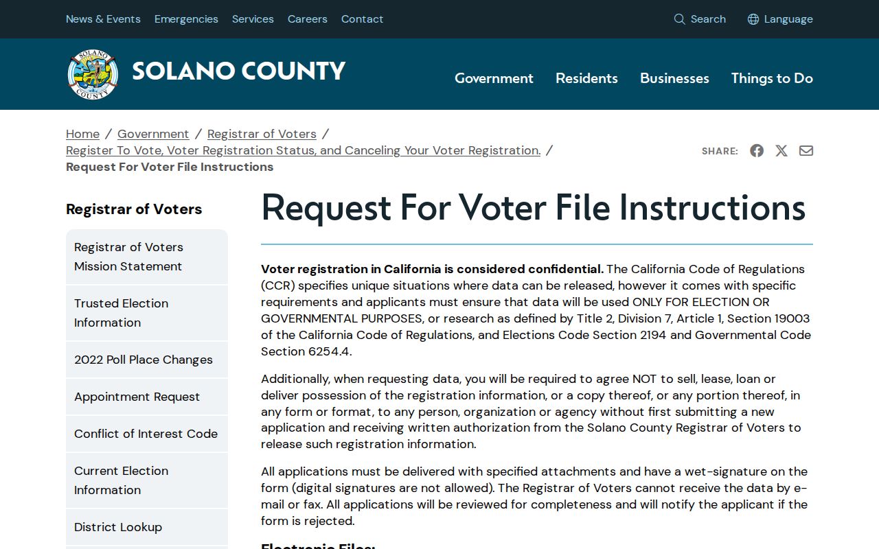
The Vallejo application and permitted-use rule are part of the record, not a detail to skip.
The Solano Registrar of Voters page supplies the office contact and registration context.
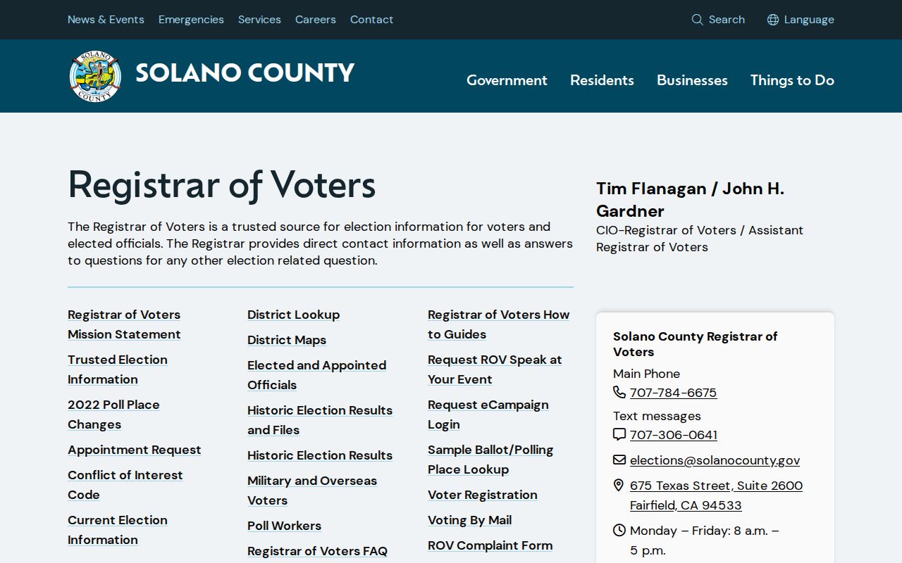
Use the Registrar for the official Vallejo application, current Vallejo contact details, and the rules for any approved geographic extract.
Historical Vallejo Households in Print
A dated criss-cross section can show who or what appeared at nearby street numbers in a past Vallejo publication. The reported Vallejo city-directory collection spans 1870-1991, with gaps to verify. Use the alphabetical entry, abbreviation key, street section, and page reference together. Then compare the result with census, obituary, deed, or permit evidence.
Historical Vallejo households are snapshots. A directory may show Vallejo neighbors in a past publication, omit a household, list a business, use an old street number, or capture a move between years. The source can add context to a Vallejo block, but it does not establish a current nearby relationship. It belongs in a dated research log.
The California voter-record use statute is shown below as a reminder that a historical or current data layer still has a use rule.
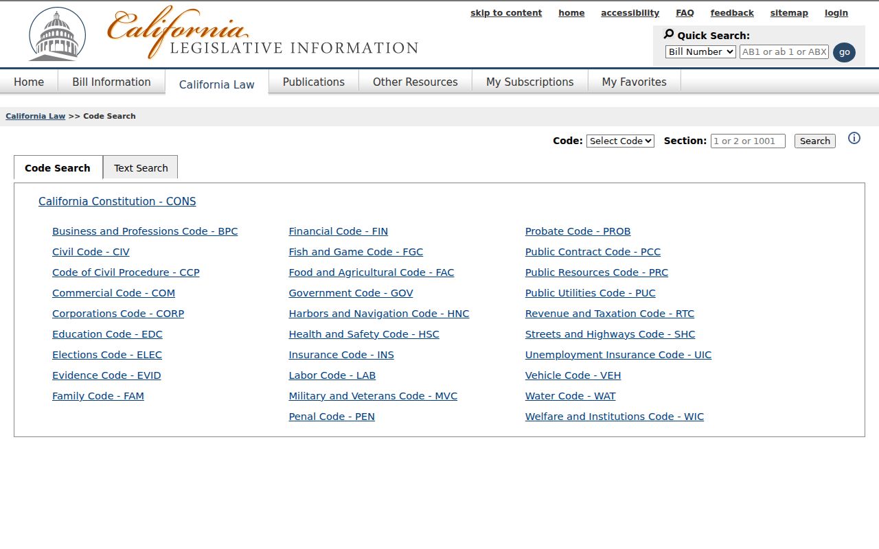
Public Vallejo civic transparency and personal research do not remove the statutory limits on Vallejo voter data or a Vallejo block search.
Public Vallejo Neighborhood Contacts
Community contacts can help a person learn a Vallejo block without asking for a private member roster. Vallejo neighborhood identities include Downtown, St. Vincent's Hill, Vallejo Heights, Heritage District, Mare Island, South Vallejo, North Vallejo, Country Club Crest, Glen Cove, Hiddenbrooke, and east-side subdivisions. Current Vallejo group names and contacts should be confirmed before use.
| Public route | Useful block clue | Boundary |
|---|---|---|
| Vallejo Neighborhood Partnership or civic program | Public meeting, service area, or contact channel | Not a member-address list |
| Police or neighborhood-watch information | Safety contact and community notice route | Not a roster of residents |
| Chamber, VFW, Rotary, or congregation | Published officers, events, or public role | Private members require consent |
| Vallejo museum community archives | Historical organization, photograph, or oral-history clue | Appointment and rights rules apply |
Public Vallejo officers and meeting contacts can support reconnecting or civic work. They should not be recast as proof that a person lives nearby. Current Vallejo community directories are voluntary and may be limited by the organization.
Vallejo Permits and a Changing Block
Vallejo building permits can explain why a block looks different across time. eTRAKiT may expose permit number, type, status, dates, valuation, applicant, contractor, and inspection milestones for the Vallejo address. A code or planning file may add a project applicant or notice. The exact historical start of the online permit system is not stated, and older Vallejo jackets may need a focused city request.
A Vallejo permit is a work relationship. It is not a current block list. Pair a permit with the APN, map, and dated directory or census evidence. A subdivision, split, or new unit can change parcel and address patterns, so the block log should preserve old and new identifiers.
Vallejo's neighborhoods also carry different source histories. Mare Island brings federal and museum records; older central Vallejo districts reward Sanborn sheets and directories; later subdivisions may have stronger parcel and permit trails.
Vallejo Recording Alerts for Blocks
Solano's Recording Notification Program mails Vallejo owners when a deed, quitclaim deed, or deed of trust is recorded against a subscribed property. It is an alert, not title insurance and not an automatic block on recording. A neighbor who receives a notice should audit the APN or PIN in Official Records and obtain the instrument from the Recorder through the official Vallejo route.
The Solano recording-notification page is pictured below.
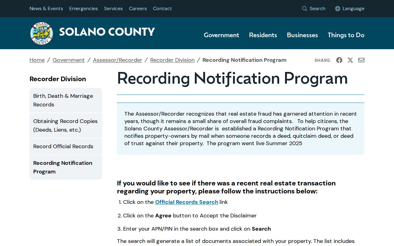
Neighbors who receive an alert can protect a Vallejo parcel from a surprise filing, but the notice does not reveal every person connected to the Vallejo block.
Privacy Limits on Vallejo Neighbors
A Vallejo block lookup cannot show every occupant, child, visitor, utility customer, delivery account, protected person, or private association member. Voter addresses and identifiers are protected. Safe at Home can substitute a mailing address for eligible Vallejo participants, but it does not erase old public records. A recorded legal description can still reveal a property location. Public record availability is not consent to contact.
Commercial block compilations can lag corrections, merge same-name people, and confuse assessed owners with occupants. Official Vallejo rolls are narrower but traceable. Use the source that fits the Vallejo question, save the as-of date, and stop when the custodian's privacy rule applies.
| Evidence layer | Strength | Limit |
|---|---|---|
| Official parcel and deed records | Traceable land and recorded-party evidence | Not a complete occupant list |
| Approved civic or voter data | Controlled geographic fields for an authorized use | Not public browsing |
| Community contact | Voluntary public role or meeting channel | Does not prove residence |
| Commercial compilation | Possible lead across mixed sources | Stale, costly, and hard to verify |
The California voter confidentiality provision is the source for protected voter fields.
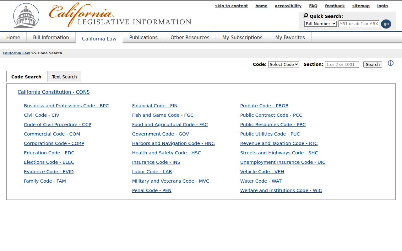
The privacy boundary remains part of a good Vallejo neighbor lookup and every Vallejo block note for a Vallejo parcel.
Lawful use. Vallejo neighbor records are for personal, lawful research, reconnecting, civic awareness, and Vallejo safety planning. Do not stalk, harass, intimidate, impersonate, or harm anyone. Use police or court channels for an urgent safety issue.